
Przewodnik
24/06/2026
Poznaj Ski Dubai, czyli stok narciarski w Dubaju
Kopiuj link

Bartosz Jaglarz
15 stycznia 2026
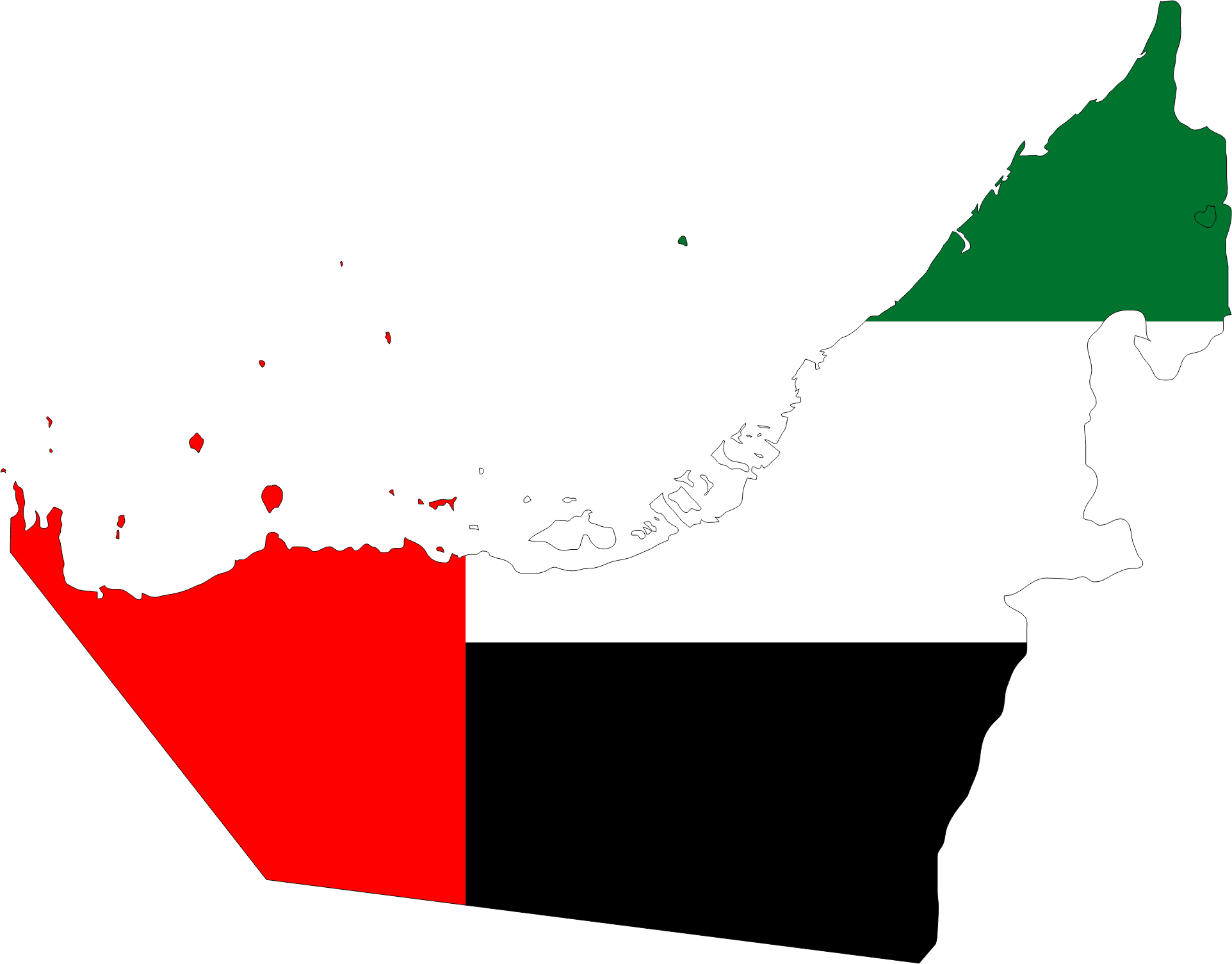
Zjednoczone Emiraty Arabskie to państwo znane na świecie przede wszystkim z nowoczesnej aglomeracji Dubaju, tradycyjnych zabytków Abu Dhabi i pięknych plaż oraz natury w Ras Al-Khaimah. Poznaj bliżej ten niesamowity kraj i zobacz jak wygląda mapa Zjednoczonych Emiratów Arabskich.
Gdzie leżą Zjednoczone Emiraty Arabskie mapa – ZEA to państwo położone w południowo-zachodniej Azji, na Bliskim Wschodzie, konkretnie na Półwyspie Arabskim. Graniczy z Arabią Saudyjską i Omanem, chociaż na taki region jak Półwysep Arabski mapa obejmuje więcej państw w pobliżu Emiratów. Zjednoczone Emiraty Arabskie mają dostęp do dwóch akwenów wodnych: Zatoki Perskiej i Zatoki Omańskiej. Poznaj więcej szczegółów w naszym przewodniku po lokalizacji Zjednoczonych Emiratów Arabskich.
Położenie Zjednoczonych Emiratów Arabskich ma swoją wyjątkową charakterystykę poprzez podział administracyjny, który jest jednym z najbardziej wyjątkowych podziałów administracyjnych świata. Dlaczego? ZEA to federacja składająca się z siedmiu emiratów, które działają jak autonomiczne "mikropaństwa", każdy rządzony przez własnego emira. Emiraty to właśnie islamskie państwa, odpowiedniki europejskich księstw. W podział administracyjny wchodzą następujące emiraty składowe ZEA: Abu Dhabi (stolica), Dubaj, Szardża, Adżman, Umm al-Kajwajn, Ras al-Chajma i Fudżajra.
Żeby lepiej przygotować się do wycieczki do Dubaju i innych miast Zjednoczonych Emiratów Arabskich, warto wcześniej zapoznać się z przewodnikiem po Dubaju z planem zwiedzania, w którym znajdziesz wiele przydatnych informacji na urlop w ZEA oraz z poradnikiem o najlepszych atrakcjach w Dubaju. Jeśli natomiast ciekawią cię geograficzne informacje o Zjednoczonych Emiratach Arabskich, takie jak mapa administracyjna lub fizyczna kraju, czytaj dalej:
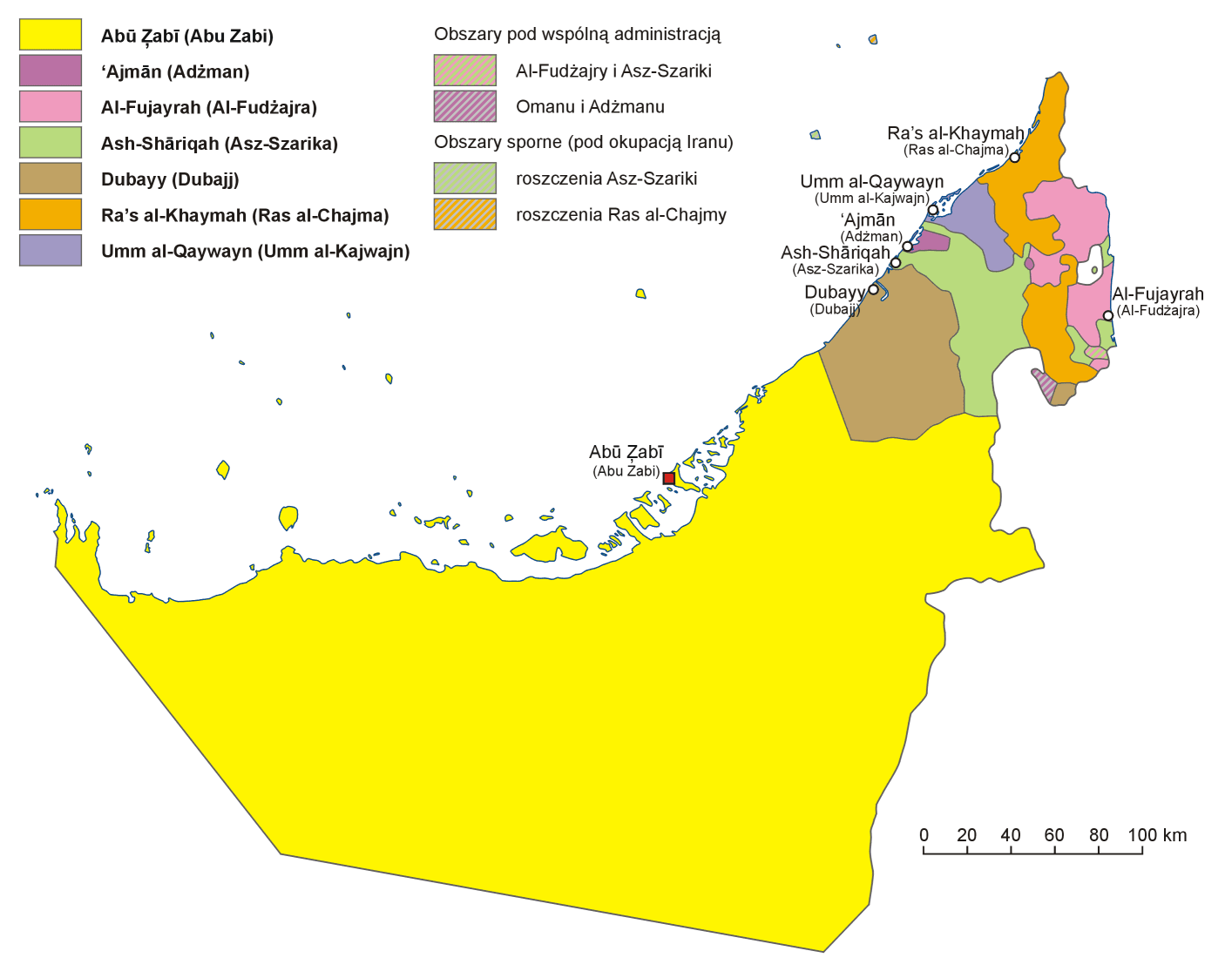
Mapa Emiratów Arabskich Dubaj Abu Dhabi – jest to dokładna mapa administracyjan Zjednoczonych Emiratów Arabskich, ukazująca podział na 7 emiratów z włączeniem enklaw, obszarów pod wspólną administracją i obszarów spornych. Zaprezentowana ZEA mapa kraju z miastami jasno prezentuje, że stolica Abu Dhabi to również największy powierzchniowo emirat w ZEA. Granice ZEA są tu zaznaczone, ale bez sąsiadów. Z jakimi krajami graniczą Zjednoczone Emiraty Arabskie? jednoczone Emiraty Arabskie sąsiadują z Arabią Saudyjską i Omanem. Jakie miasta znajdują się na mapie ZEA? Na mapie Zjednoczonych Emiratów znajdziesz takie miasta jak: Dubaj, Abu Dhabi, Szardża, Adżman, Ras Al Khaimah, Umm al-Quiwan, Fujairah, Kalba, Khor Fakkan i Dibba Al-Fujairah.
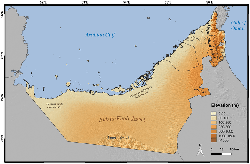
Mapa geograficzna/fizyczna Zjednoczonych Emiratów Arabskich może nam wiele powiedzieć o tym kraju. Przede wszystkim widzimy, że większość państwa jest pochłonięta terenem pustyni Rub al-Khali. To największa piaszczysta pustynia na świecie i jedno z najgorętszych miejsc na ziemi. Można też zauważyć, że ZEA mają też góry i tereny sięgające powyżej 1000 metrów n.p.m. Może też cię zaciekawić: Czy ZEA leżą w Azji czy w Afryce?
Jeśli szukasz w internecie takich pojęć jak: Dubaj mapa, Abu Dhabi mapa, Szardża mapa, czy Zatoka Perska mapa, to znak, że albo wyjątkowo mocno interesujesz się Bliskim Wschodem, albo marzysz o wakacjach w ZEA! Spełnij swoje marzenia, zarezerwuj komfortowy nocleg w Dubaju w prywatnym apartamencie ze wspaniałym widokiem na miasto, kup interesujące atrakcje w Dubaju oraz wycieczki na pustynię i poznaj Zjednoczone Emiraty Arabskie bliżej z Two Continents.
Tak, Zjednoczone Emiraty Arabskie leżą nad wodami Zatoki Perskiej (na północy) i Zatoki Omańskiej (na wschodzie), która łączy się z Oceanem Indyjskim, co zapewnia ZEA długą linię brzegową i dostęp do morza. Jedyny emirat na wschodnim wybrzeżu, Fujairah, ma bezpośredni dostęp do Zatoki Omańskiej i Oceanu Indyjskiego, co czyni go popularnym miejscem do nurkowania i snorkelingu.
Jeśli spojrzysz na mapę Zjednoczonych Emiratów Arabskich, to Dubaj leży wysunięty na północny-wschód od centrum kraju. Na południu od Dubaju znajduje się Abu Dhabi, a na północny Szardża, Umm Al Quwain, Ajman i Ras Al Khaimah.
Zjednoczone Emiraty Arabskie składają się z siedmiu emiratów, którymi są: Abu Dhabi, Dubaj, Szardża, Ajman, Umm Al Quwain, Ras Al Khaimah i Fujairah, a każdy z nich jest rządzony przez emira, tworząc federację o unikalnym systemie rządów.
Zobacz inne newsy
24/06/2026
Poznaj Ski Dubai, czyli stok narciarski w Dubaju

24/06/2026
Deira Perfume Souk przewodnik: gdzie znaleźć najlepsze zapachy?

24/06/2026
Zwiedzanie Dubaju z dzieckiem – jakie atrakcje najlepiej wybrać?
24/06/2026
Abu Dhabi – najlepsze atrakcje. TOP 30 miejsc, które warto zobaczyć w stolicy ZEA

24/06/2026
Mezze – czym jest i jak zamawiać arabskie przystawki
24/06/2026
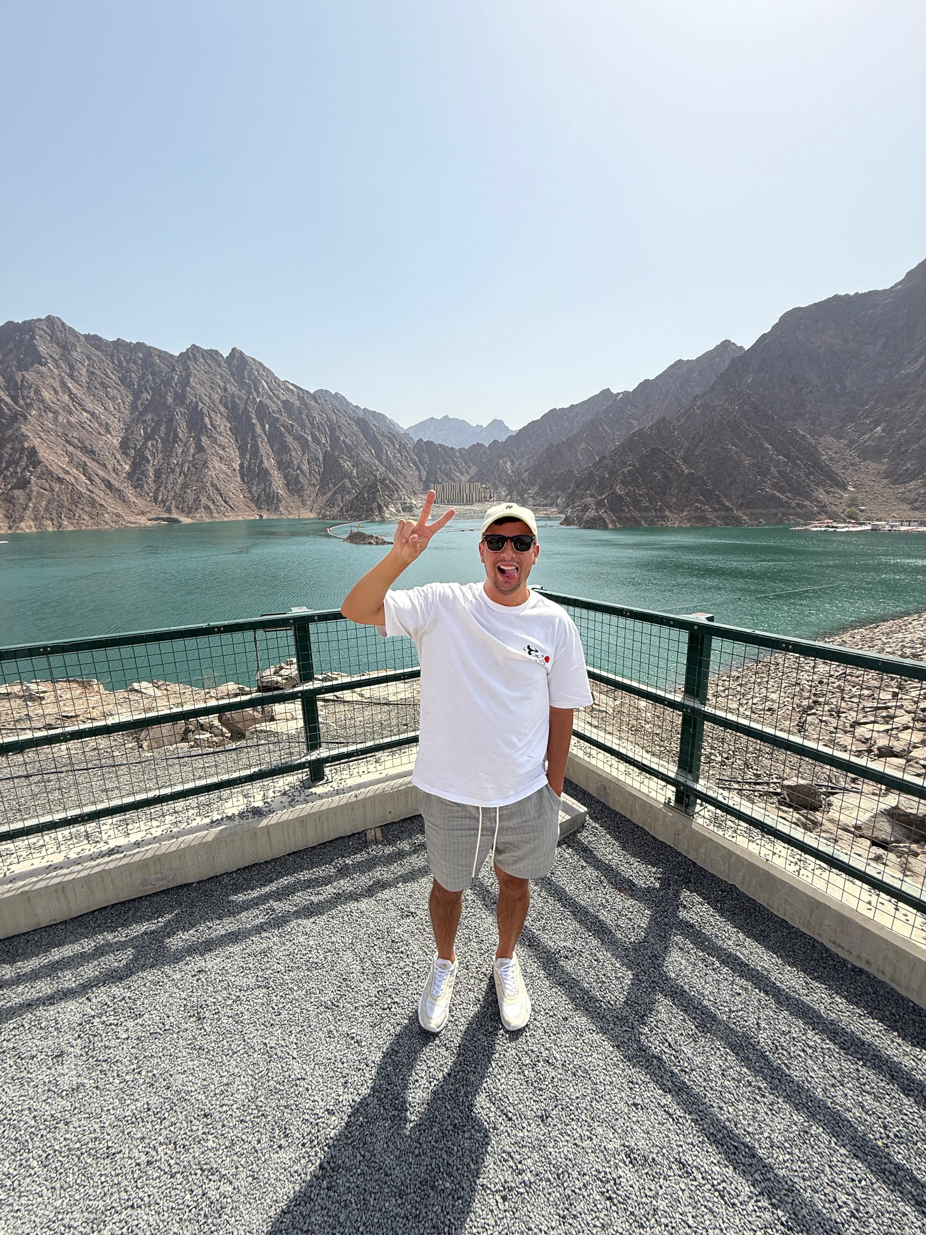
Hatta – górska ucieczka od upału w emiracie Dubaj

23/06/2026
KidZania Dubai – miasteczko zawodów dla dzieci

23/06/2026
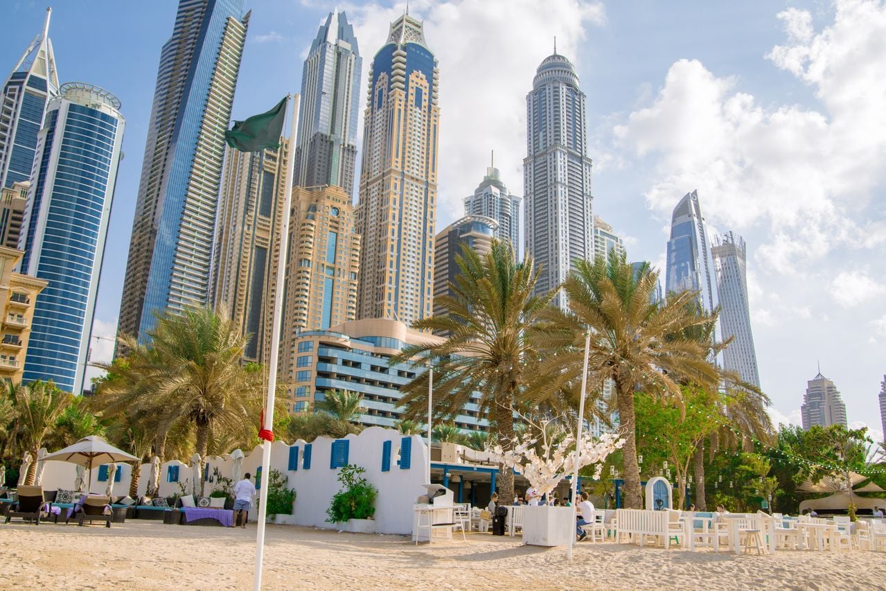
Dubai Marina Walk – promenada wzdłuż wody
23/06/2026
Dubaj latem – czy warto jechać w czerwcu, lipcu i sierpniu?

23/06/2026
Armaf – recenzja marki perfum arabskich